Services
-page-001.jpg/:/rt=d:270/cr=t:0%25,l:0%25,w:100%25,h:100%25/rs=w:600,h:300,cg:true)
Boundary Survey
Your property and all improvements including but not limited to the house, driveway, decks, sheds, garages, fences, pools, walls, etc. will be located and shown on a plat. This plat will be reviewed and certified by a Alabama Registered Land Surveyor.

Site plan
The county or city where your property is located might require a site plan if you are doing any sort of building such as a house, an addition or a pool. The site plan starts with a boundary survey and may include other items such as topography (elevations or contours) and trees. It all depends on the requirements of the county or city in which your property is located.

Parcel Split
This type of survey starts with a boundary survey of the entire tract of land. A parcel split divides one tract of land into two or more parcels.
These are typically needed if you are dividing the land among relatives as dictated by a will, if you plan to sell part of the land, needing to create a new house lot or to sell an existing house and keep some remaining acreage.

Find/mark property corners and stake property lines
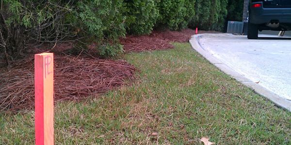
Your property corners are typically iron rods placed in the ground by the original sub-divider of the property. We will find these iron rods and verify that they are correct according to your deed. Stakes will then be placed along your property line between the property corners. This is an important service if you are installing a fence or building structures near the property line.

ALTA/NSPS Survey
This type of survey is extremely detailed. It provides the lender and title insurance company with the information needed to insure the title to the land.

Construction Staking
This service is provided to contractors to assist them in the layout of new structures such as drainage, parking lots, roads, buildings, etc. Construction staking by a Professional Land Surveyor can eliminate errors on the construction site and speed up construction schedules.
As-built and Foundation Survey
As- built surveys may be required to show that certain structures were built in compliance with the plans.
Foundation surveys are typically required when building new homes, buildings, etc. to verify that the new structure meets the building set back requirements.

Topographic Survey
Topographic surveys show the height, depth, size and location of any manmade or natural features on a given parcel of land, as well as the changes or contours in elevation throughout the parcel. While boundary surveys focus on horizontal measurements, topographic surveys are about elevation.
Copyright © 2020 Southern Point Surveying - All Rights Reserved.
Powered by GoDaddy Website Builder